
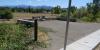
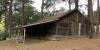
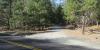
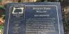
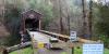
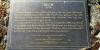
Historical Markers & Sites In Jackson County, Oregon

  • HOME
  • About Us
    • Ask Us a Question
    • Leave a Message
  • All Markers
  • Map
  • The 1800s
    • Bridges & Ferries, 1800s
    • Mining
    • Native American
    • Railroads
    • Roads
      • Applegate Trail
      • Siskiyou Mountain Wagon Road
    • Town Sites - Cemeteries
  • Agriculture
    • Heritage Trees
  • Government
    • Airports
    • CCC Camps
    • Covered Bridges
    • Law Enforcement
    • Military
    • Municipal Markers
  • Private Memorials
  • Help

West

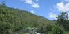
Generally west of I-5 (except markers clustered in the southeast area). Covers markers west of Central Point's longitude

Rock Point Bridge manufacturer of railroad rail used in marker
Applegate Trail 15: Old Stage Road near Jacksonville by the road
Applegate Trail 16: Valley of the Rogue Kiosk, in the State Park signs
Birdseye Spring Marker newspaper article
Buncom Buncom
CCC Camp: Wrangle Gap Shelter Wrangle Gap Shelter
Chavener’s Bridge Near marker
Dardanelles Marker gas station
Evans Ferry near the marker
Fort Birdseye near the marker
Gin Lin Trail by the road
Hanley Farm Hanley Farm
Hanley Farm Willow the markeri
Logtown Cemetery cemetery bulletin board
McKee Covered Bridge the bridge
Rock Point Stage Stop the markeri
Ruch Historical Marker the marker
Sterlingville Cemetery the cemetery
Story Telling Stone Marker near the marker
Takelma Salmon Ceremony Marker by the road
  • Contact
  • Login